Quick FactsOverview
About Lower Warm Springs
Lower Warm Springs, California is the largest and most developed of three thermal spring areas in the Saline Valley of Death Valley National Park, accessible only via approximately 50 miles of unpaved dirt road in one of the most remote sections of the park.
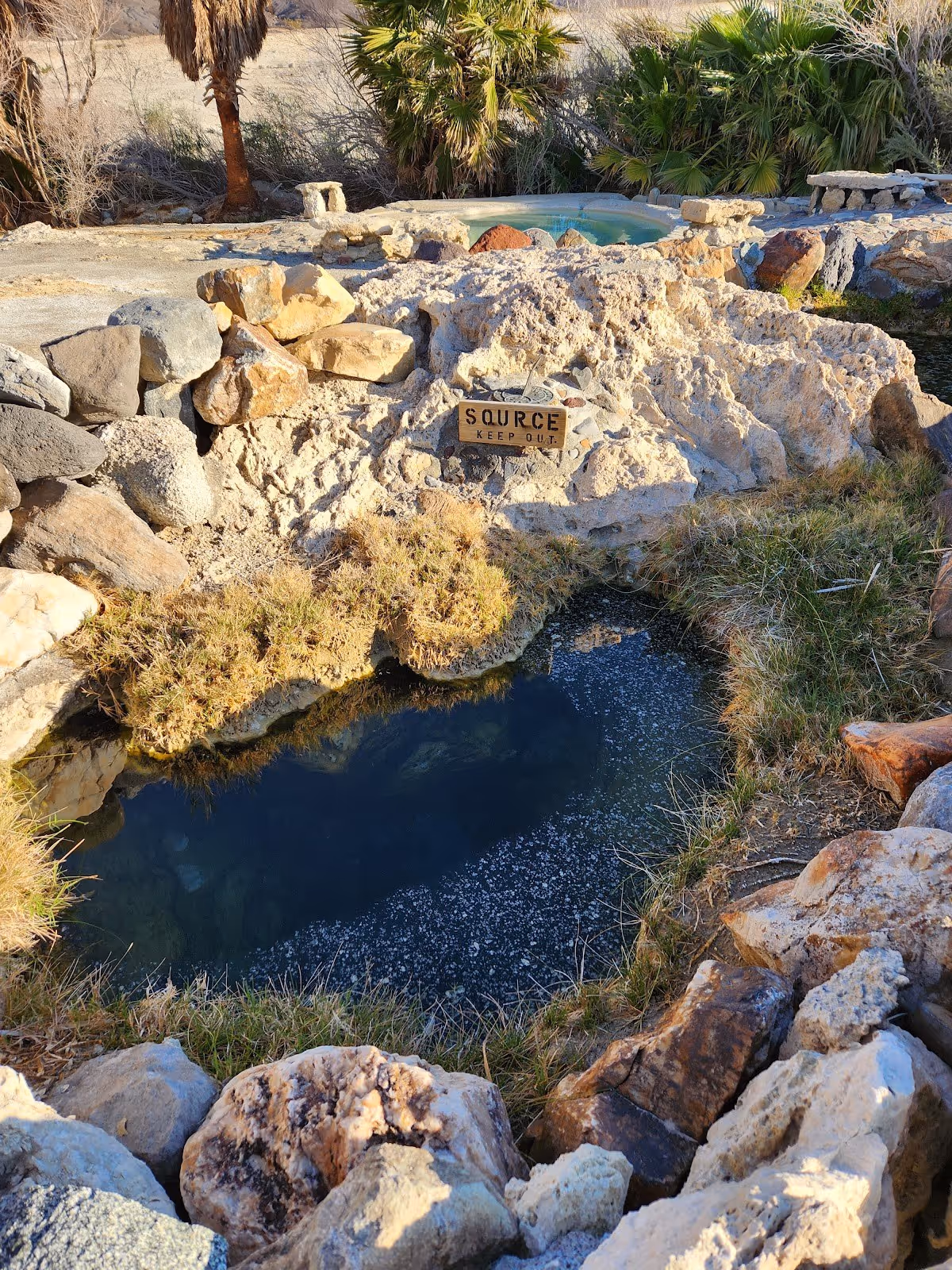
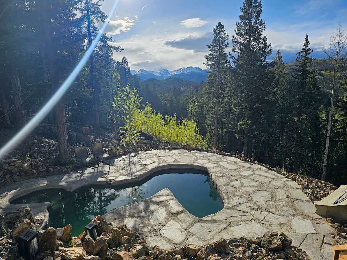
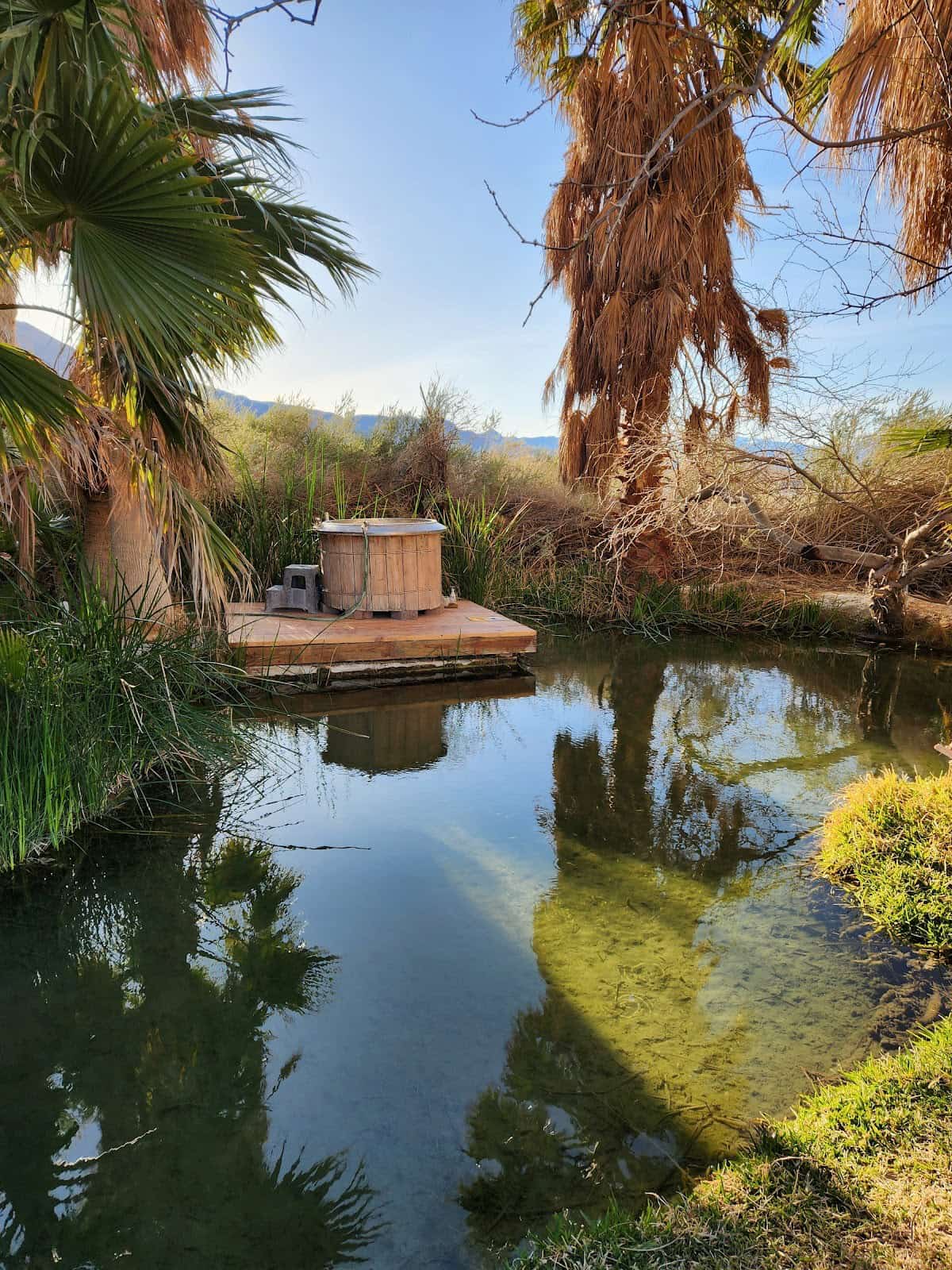
The lower springs consist of a series of primitive soaking pools constructed from local volcanic rock, concrete, and tile by a long-established volunteer community. Vault toilets, a communal fire ring, and basic washing facilities are present, built and maintained by regular visitors rather than the NPS. The source spring flows at approximately 107 degrees Fahrenheit, with the distributed pools offering varying temperatures. Dense native vegetation provides shade in the lower area, making it more sheltered than the adjacent Palm Spring further up Saline Valley.
The site became part of Death Valley National Park in 1994 and is managed under a 2019 NPS plan that preserves the clothing-optional tradition and limits stays to 30 days per year. The springs do not appear on official NPS maps. Camping is free beyond the park entrance fee. For visitors looking for natural hot springs in California at the far end of remote and self-supported, Lower Warm Springs is in a category of its own.
Location & Access
Getting to Lower Warm Springs
Lower Warm Springs is reached via Saline Valley Road, an entirely unpaved route entering from CA-168 near Big Pine to the north or CA-190 near the Death Valley boundary to the south, with the springs approximately 50 miles from either paved entry point. The north route from Big Pine is generally considered the more approachable option for first-time visitors and takes three to four hours one way under reasonable conditions.
From Big Pine, take CA-168 east, then turn onto Waucoba Road and follow Saline Valley Road south into the valley. The road climbs a high-elevation pass before a long descent. All routes are unpaved, subject to snow closure in winter and flash flood damage in summer, and include long stretches of washboard that limit speed to 10 to 20 miles per hour. A steel bat sign and a stand of tall palm trees mark the approach to the springs area.
No cell service exists anywhere in Saline Valley. Gas, food, and emergency services are in Big Pine, roughly 55 miles away. Hot springs near Big Pine at the roadside level are plentiful along US-395, but Lower Warm Springs demands a fundamentally different level of commitment: a full day of driving, expedition-level supplies, a satellite communicator, and at minimum one additional vehicle traveling with the group.
Suitability & Accessibility
Who Lower Warm Springs Suits
Lower Warm Springs suits experienced off-road and backcountry visitors who are comfortable with remote desert travel, multi-day self-sufficiency, and operating without cell service or emergency infrastructure. The site is not appropriate for casual visitors, families with young children, or anyone without a capable high-clearance vehicle and full desert preparedness.
The clothing-optional tradition at the springs is long-standing and effectively accepted under NPS management. The community that regularly visits is self-organizing, with strong informal norms around pool maintenance, Leave No Trace, and mutual respect among visitors. First-time visitors who arrive with the required preparation and the right mindset will find an unusual and welcoming environment in a setting unlike any other natural hot springs in California.
The pools themselves are at ground level and the immediate terrain around the springs is relatively flat, but the 50-mile access road makes any visit impossible for people with mobility limitations or without a suitable vehicle. The site is best visited October through April. Summer temperatures in Saline Valley regularly exceed 110 degrees Fahrenheit, posing genuine life safety risk, and summer visits are strongly inadvisable for any visitor regardless of experience level.
Safety & Etiquette
Safety at Lower Warm Springs
Lower Warm Springs presents serious and genuine safety risks that are entirely the visitor's responsibility to manage. There are no rangers at the springs, no cell service in Saline Valley, and no emergency response infrastructure within practical reach. A vehicle breakdown or medical emergency at the site could require a wait of many hours before outside help arrives, making thorough preparation non-negotiable rather than optional.
Summer heat is the most significant hazard. Saline Valley records air temperatures above 120 degrees Fahrenheit during peak summer months, and heat-related deaths have occurred in Death Valley National Park. Visiting between May and September is strongly inadvisable. Even in the recommended season of October through April, daytime temperatures can be significant, and visitors should carry far more water than they expect to need, with a minimum of one gallon per person per day as a baseline rather than a target.
Vehicle preparation is essential. The route involves 50 miles of unpaved road with rocky surfaces and washboard that can cause tire damage, loosened components, and mechanical stress on the vehicle. A full-size spare tire, tire repair tools, extra fuel covering the full round-trip distance plus a meaningful margin, and familiarity with basic roadside repair are all required. A satellite communication device such as a personal locator beacon or two-way satellite messenger is strongly recommended and considered standard equipment by experienced Saline Valley visitors.
At the springs, avoid submerging the head in geothermal water as a precaution. Keep pools clean, pack out all waste, and respect the volunteer infrastructure. Photography of other visitors requires their consent. Stays are capped at 30 days per year per person.